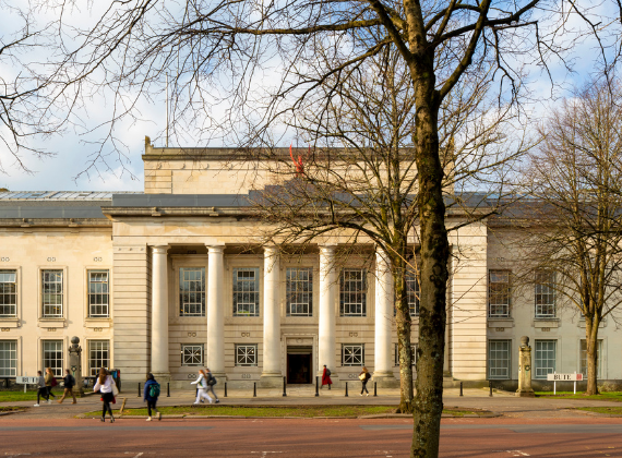
|
CASE
STUDY: Stockholm's
Green Infrastructure
This case study is also
available in pdf format.
SECTOR:Green-Blue
COUNTRY:Sweden
BACKGROUND
Greater Stockholm has retained a great deal of its natural and cultural
landscape. The population growth has certainly meant that an increasing
amount of land has been required for urban settlement but the built-up
area is still limited. Even in the city of Stockholm the undeveloped area
(land and water) is 47% of the total area.
The urban settlement has mainly
been developed in a star-like pattern. From the beginning the undeveloped
wedges to a great extent were royal parks, land belonging to noble families,
or military excercise fields. When the urbanised area expanded, the building
of neighbourhoods have been coordinated with the building of railway and
underground systems, and have been situated to areas between royal, military
and other restricted areas. Later on, these areas with restricted access
have been transformed to recreational, forestry or agricultural areas.
The star-shaped urban development
has formed a sort of structure with green wedges between the settlement
and traffic zones. That means that most of the stockholmers have good
public transport as well as green areas in the vicinity.
The green wedges begin in the
city centre of Stockholm, stretching out to the rural area outside Stockholm.
They support many functions. Firstly, they are of great importance for
the amenity of the city, as well as for recreation. And the link between
the city’s greenery and the surrounding countryside is of great
significance for the potential for maintaining a functioning ecosystem
and a natural biological diversity even in the central parts of the region.
The vegetation improves the air quality in a considerable way, and storm
runoff water from the built-up areas can be infiltrated in these areas.
.

Stockholm's gree
wedges ("....kilen" = wedge). Grey = developed areas (including
parks and small natural areas)
The City of Stockholm is developing
a ”Green map” as a tool for land use planning. It consists
of three parts: biotope map, recycling map and sociotope map. The biotopes
are identified from landscape ecology points of view, and the map makes
it possible to valuate biodiversity. The recycling map identifies areas
for recycling of nutrients from composting and treated waste water, for
storm runoff water treatment, for energy forestry, for shelterbelts and
so on. The sociotope map introduces the concept sociotope in planning,
and is a way of managing sociocultural aspects. A sociotope is a defined
area (a biotope, or several biotopes) used for social functions (shore
- bathingplace; meadow - recreation area).
INDICATORS
• Amenity
• Recreational use
• Biodiversity
• Areas for storm runoff water treatment
• Areas for recycling of nutrients
• Areas for waste water treatment
• Areas for energy production
• Areas for shelterbelts and improvement of urban climate
EVALUATION
The green wedges are, among other things, meant as ecological corridors.
To be efficient for migration for many groups of plant and animal species,
they should contain a broad spectrum of biotopes within distances these
species can bridge over. At certain places they show significant problems
due to lack of space, which means that the corridors can not contain all
biotopes needed for migration. Therefore they are broken for many groups
of species at these places.
Significant areas can be used
for waste water treatment, for recycling of nutrients, for energy forestry,
and so on. Evaluation is going on in the Stockholm region and in other
city areas.
Preliminary results from Stockholm are:
• The green wedges are of great social and recreational value to
the local occupants. There is usually room for measures for sustainability
without making significant impact on recreational values. Measures as
ponds and shelterbelts can be designed to increase amenity as well as
biodiversity and recycling functions.
• An area to a distance of about 70 km should be used to recirculate
all nutriants from waste water and solid waste to agriculture.
Preliminary evaluation from
other areas and other cities implies:
• In suburban areas, almost all storm runoff water can be infiltrated
and perkolated in small areas between the buildings and in the green wedges.
Design is of great importance to avoid problems. Just in areas with very
poor infiltration capacity, usually lowlands with clay or silt dominated
soils, problems occur. In densely built-up areas just part of the runoff
water can be infiltrated.
• Nutrients from private household composts can usually be recirculated
within the green infrastructure. The close relationship between built-up
areas and green area, which is supported by the green wedge structure,
is important for this.
• The amount of nutrients produced in waste water plants are about
6 times bigger than that from solid compostable waste. Just a limited
part of these nutrients can be fully treated and recirculated within the
greenstructure of the city. However, defined areas can be used for the
last treatment stage, that is final nitrogen reduction. For this purpose,
ponds and small creeks should be used. A wedge structure supports this.
• Green areas can be used for energy production. Areas within the
city are far less than those needed for heating ordinary residential areas
in the Swedish climate. On the other hand, ”ecological buildings”
can be designed for a very limited energy use. In that case energy forestry
within the city might be sufficient. A wedge structure has limited importance
for this.
However, it must be pointed out that the main values of the green wedges
still are recreation and amenity.
BENCHMARK DATA There are no benchmark data agreed
for green infrastructure as area for biodiversity, for nutrient recalculation
and so on.
DRIVERS
Formally, there are international drivers like Agenda 21 and other
agreements, often coming from UN meetings, and national drivers like the
Swedish Planning and Building act, which was altered in 1996 to include
preservation of green structure within cities. However, there is little
attention payed to these agreements and acts if there are no or week public
opinion. The main driver for preservation of green structure is, and has
always been, the political pressure formed by the opinion by the people
using the green structure for recreation. This has lead to that the green
wedges has been taken care of by the local authorities in the comprehensive
plans. The last decade this has been supported by the insight of the possibility
to utilize the green structure for such needs as water treatment, shelterbelts
and so on.
LESSONS LEARNT
If one makes a map of proposed new highways, deposits, sites for motor
competitions and so on, and puts it over a map of the green structure,
these to images will to a great extent overlap. That means, that noisy
and polluting activities are proposed to recreation areas. The decision
makers will not locate such activities close to residential areas, and
therefore the disturbances are proposed to areas where nobody lives. On
the other hand, such activities has many times been rejected from the
green wedges due to public opinion. For example, a highway proposed to
a part of the green structure to the west of Stockholm City, has so far
been rejected. New solutions should be created. In this case, traffic
could be decreased by measurements presented in the case study of Zürich,
sector Transport.
APPLICATION
A wedge-like green structure can be established if there are non-developed
areas within the city structure, or if developed areas are abandoned.
The latter will usually happen according to economic changes. In the latter
case, the land has to be reclaimed. This can be quite expensive. However,
there are many examples that planning can solve the problem. New development
on attractive sites can create economic circumstances to reclaim areas
at the site.
TRANSFERABILITY
Due to economic driving forces, cities often will expand all over
the land. A wedge-like green structure is seldom created by physical planning,
and if it is, it usually is hard to keep development out of the structure.
In the Stockholm case, other strong forces have created many parts of
the present green structure. That means, that for establishment of a green
structure, planners and politicians have to be prepared, and take the
opportunity to act when the chance appears. This can occur when military
forces move out from exercise fields, or when industrial areas, harbours,
railway areas a. s. o. are abandoned. Preparation not just means that
physical plans should be prepared, it also means that the decision makers
have to inform public in advance to make the possibilities aware. In that
sense, green structure could be established anywhere.
SUMMARY
OF IMPACT ON SUSTAINABILITY
| Ecology |
|
Economy |
|
Social
aspects
|
|
| Emissions?
a)
|

|
Cost/effective?
c) |

|
Participation?
f) |
 |
| Use
of natural
resources?
Recycling? |

|
Willing
to pay? d) |
 |
Transparency?
g) |
 |
| Bio-diversity?
b)
|
 |
Effective
organisation?
e) |

|
Safety?
Health?
Amenity?
h) |
 |
| Total
|
 |
Total |
 |
Total |
 |
a) Possible
(but not measured) increased car use for transportation due to increased
transportation distances.
b) A special programme for recycling of solid waste produced in the central
part of the blue-green infrastructure will be developed (2004).
c) Very high; parts of the green wedges of Stockholm are unique in an
international perspective, and are conserved by law in a “Urban
National Park”.
d) Possible (but not measured) impact on production economics due to increased
transportation distances; on the other hand less demand for citizen’s
transportation by car to recreation areas.
e) Not studied within the area, but several studies indicates willingness
to pay for green infrastructure, and increased property values for properties
located close to green areas.
f) Supervising organisation without formal power; many institutions involved;
weak organisation within local governments. On the other hand, the supervising
Office of Regional Planning and Urban Transportation has strong support
from many citizens concerning preservation of the blue-green infrastructure.
g) Good possibilities for NGOs and the public to communicate with local
governments and authorities.
h) Information is easily available and easy to understand, but the fact
that many institutions are involved in the planning process makes the
process difficult to follow.
i) Many parts of the blue-green structure give Stockholm its special image
(“The Venice of the North”), and are looked upon as national
heritage.
PROJECT
CONTACT
Ulrika Egero
City of Stockholm, Strategic
Planning Dept
Box 8314, SE-10420, Stockholm, Sweden
ulrika.egero@sbk.stockholm.se
+46 (0) 8 508 826000
Better Lundh
Malmros
Stockholm County Council
Office of Regional Urban Planning and Transportation
Box 4414, SE-10269, Stockholm, Sweden
bette.malmros@rtk.sll.se
+46 (0) 8 7372500
+46 (0) 8 7854000
REFERENCES
- Dahlberg, G.-B. 1999. Baltic
Palette/Best Practice. Interreg IIC-project
- Florgard, C. & Berg,
P. G. 1997. The Function
of Urban Green Structure in Sustainable Urban Development. In:
Guldager, S. & Nilsson, K. (eds.) (1997) Ressourcehusholdning
i kommunernes planlaegning og forvaltning af friarealer. Proceedings
of Nordic workshop, March 1996. Research Centre for Forest and Landscape,
Hoersholm 1997, pp 31-38.
- Gronstrukturen I Stocksholmsregionen.
Regionplane - och trafikkontoret, rapport 1996:2. Stockholm
- Regional Development Plan
2001 for the Stockholm Region – RUFS 2001. Regionplane- och trafikkontoret
(Office of Regional Planning and Urban Transportation), Stockholm. (2002)
- Social values. Assessing
the public appeal in urban green area. Regionplan-och trafikkontoret,
Stockholm (2003)
- Stockholm Regional Green
Structure. Regionplane-ach trafikkontoret, Stockholm (1998)
- Regionplane- och trafikkontoret,
Stockholm. (2004) Upplevelsevärden i Stockholmsregionens gröna
kilar:
1. Järvakilen
2. Rösjökilen
3. Angarnkilen
4. Bogesundkilen
5. Nacka-Värmdökilen
6. tyrestakilen
7. Hanvedenkilen
8. Bornsjökilen
9. Ekerökilen
10. Görvälnkilen
|